News Archiv 2011

20.12.2011
As the first German Federal Land Bavaria offers Geodata under a free license (CC-BY 3.0). Also a Digital Terrain Model of Bavaria with horizontal resolution of 200m is available: www.vermessung.bayern.de/opendata
23.7.2011
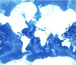
Going Deep!
For the OpenSeaMap Project GEBCO bathymetry data was processed to visualise the depths of the oceans. Click ob the image on the right and go to "Ansicht" --> "Meeresprofil" to view the data.
GEBCO only provided the data only for the visualisation through the OpenSeaMap project, therefore it is not possible to share the data itself. Hopefully this will change in the future.
23.3.2011
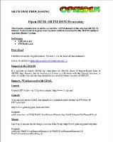
The Open DEM SRTM DSM Processing Howto is online (click on the image)
This Howto explains how to derive a void free SRTM dataset of the original SRTM 2.1 dataset. Voids occur in regions were no data could be recorded by the SRTM Synthetic Aperture Radar System .
14.3.2011
![]()
The OpenDEM Projekt will be present at the FOSSGIS Conference in Heidelberg (Germany, 5.-7.4.2011) with a Lightning Talk. Here you can download the submitted article (German only).
26.2.2011
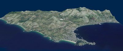
BobMaX (Blog) supplied the project with a Digital Terrain Model of Gaeta (Italy).
Downloads --> High Precision XYZ Data
6.2.2011
The OpenDEM Project just started. Here you can find Free Digital Elevation Models and Free XYZ height datasets.
High precision data (laserscan) data is available for the City of Rostock in the Download High Precision XYZ Data Section.
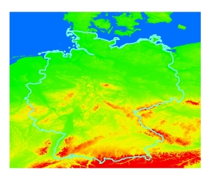
Also processed SRTM data is available were the original objects (buildings, plants) on the earth surface were filtered out on base of OSM vector data (see Technology Section). The first processed SRTM tiles are online in the Download SRTM Section. The area covered is that of Germany (see Figure on the right).
