SRTM Contours
Global ready to use contour dataset in shape format
Data Sources:
SRTM: Coverage of the World from North 60° - South 58°
Viewfinders Panoramas: Enhanced datasets for mountain areas on base of public domain datasets (look at the website of this great project for all the data sources).
Radarsat Antarctic Mapping Project: Antarctica
Geobase Canada: Northern Canada (> 60° N)
NED USGD, for Alaska: Alaska
Processing:
Contour Lines 25 m interval with GDAL:
gdal_contour.exe -i 25 -snodata -32768 -a elevation filename_rasterdataset filename_contour_shp
Example for batch processing (Windows):
call "C:\Program Files (x86)\FWTools2.4.7\setfw""
for %%f in (*.hgt) do (
set neu=%%f:~0,-6%
mkdir %%~nf
gdal_contour.exe -i 25 -snodata -32768 -a elevation %%f %%~nf/%%~nf.shp)
Creates folders for all .hgt files and put the resulting contour shapes in the created folders.
Example for sh processing (LINUX, or also with the FWTools Shell under Windows):
for f in *.hgt
do
folder=${f%%????}
mkdir $folder
gdal_contour.exe -i 25 -snodata -32768 -a elevation $f $folder/$folder.shp
done
Creates folders for all .hgt files and put the resulting contour shapes in the created folders.
Due to the side-looking radar technique used by SRTM voids occur in mountainous areas, desert areas (sand dunes) and at shorelines (see). Void pixels were ignored by the -snodata parameter, but also no contour lines for void pixels will be computed (see fig. 1).
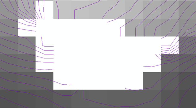
Fig. 1: Result of gdal_contour with -snodata Parameter in voided area.
Because of this the void pixels were filed with gdal_fillnodata. The algorithm is not really designed for filling large voided areas, e.g. desert areas with sand dunes. Some of this areas have been allready corrected by the Viewfinders Panorama Project (see the world coverage table).
The countours were not computed from a homogenious dataset. On the edges of two different datasources gaps could occur (see fig. 2).
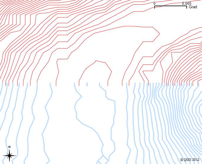
Fig. 2: Generated Contours from the SRTM dataset (south) and the US NED dataset.
The SRTM 0 Contour Line does not fit in general with the OSM costal lines (see fig. 3).
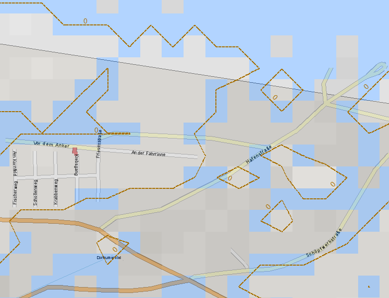
Fig. 3: OSM data overlaid over the SRTM N53E007.hgt image (north sea coast) and the resulting contour line (contour line elevation = 0m, blue pixels = value 0m).
